
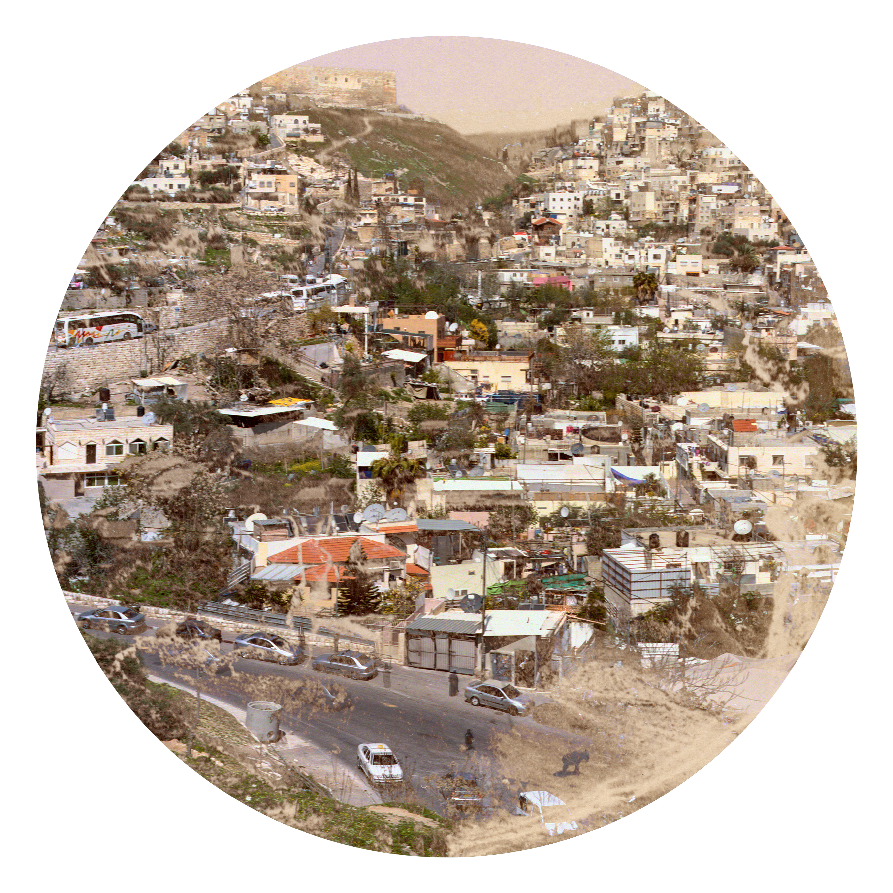

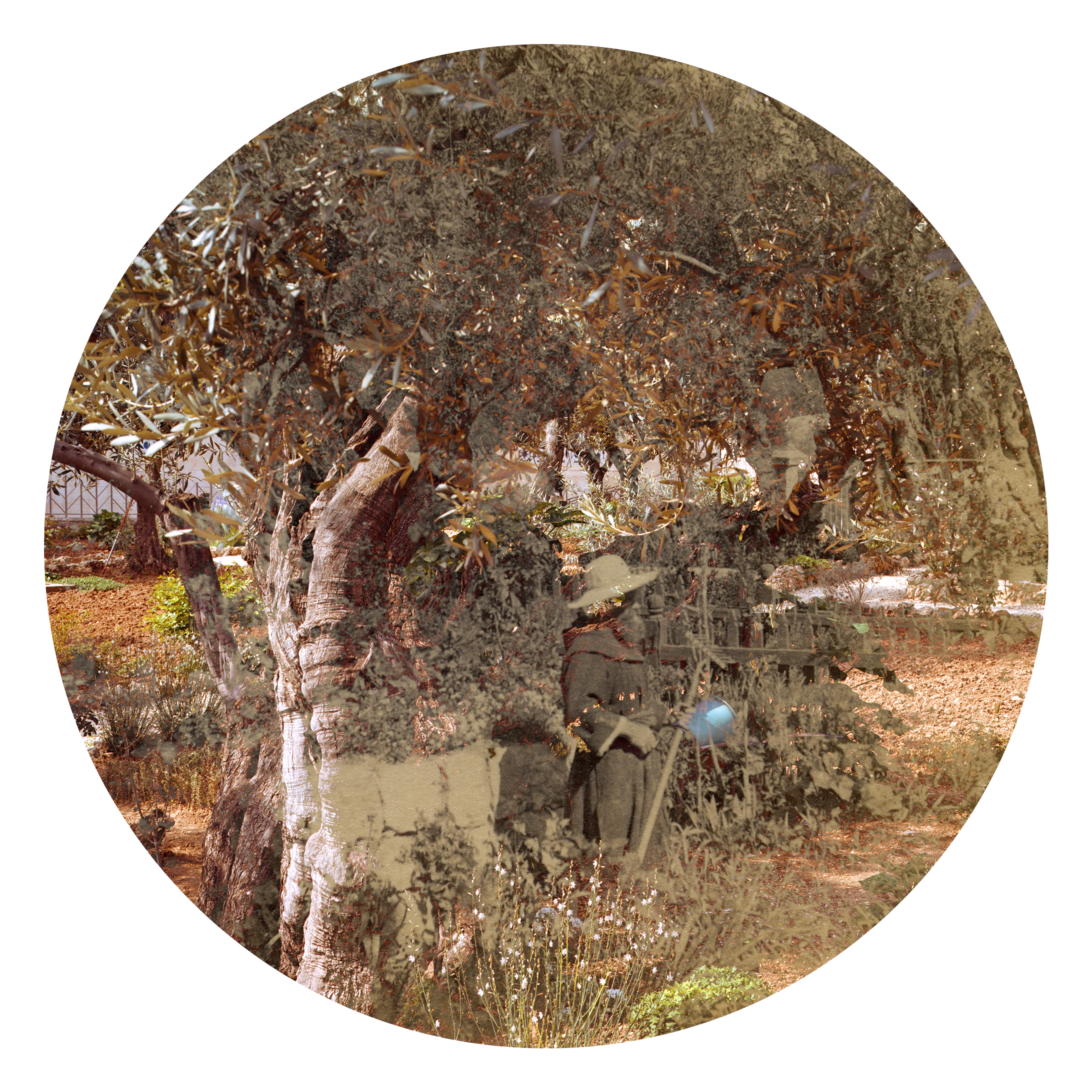

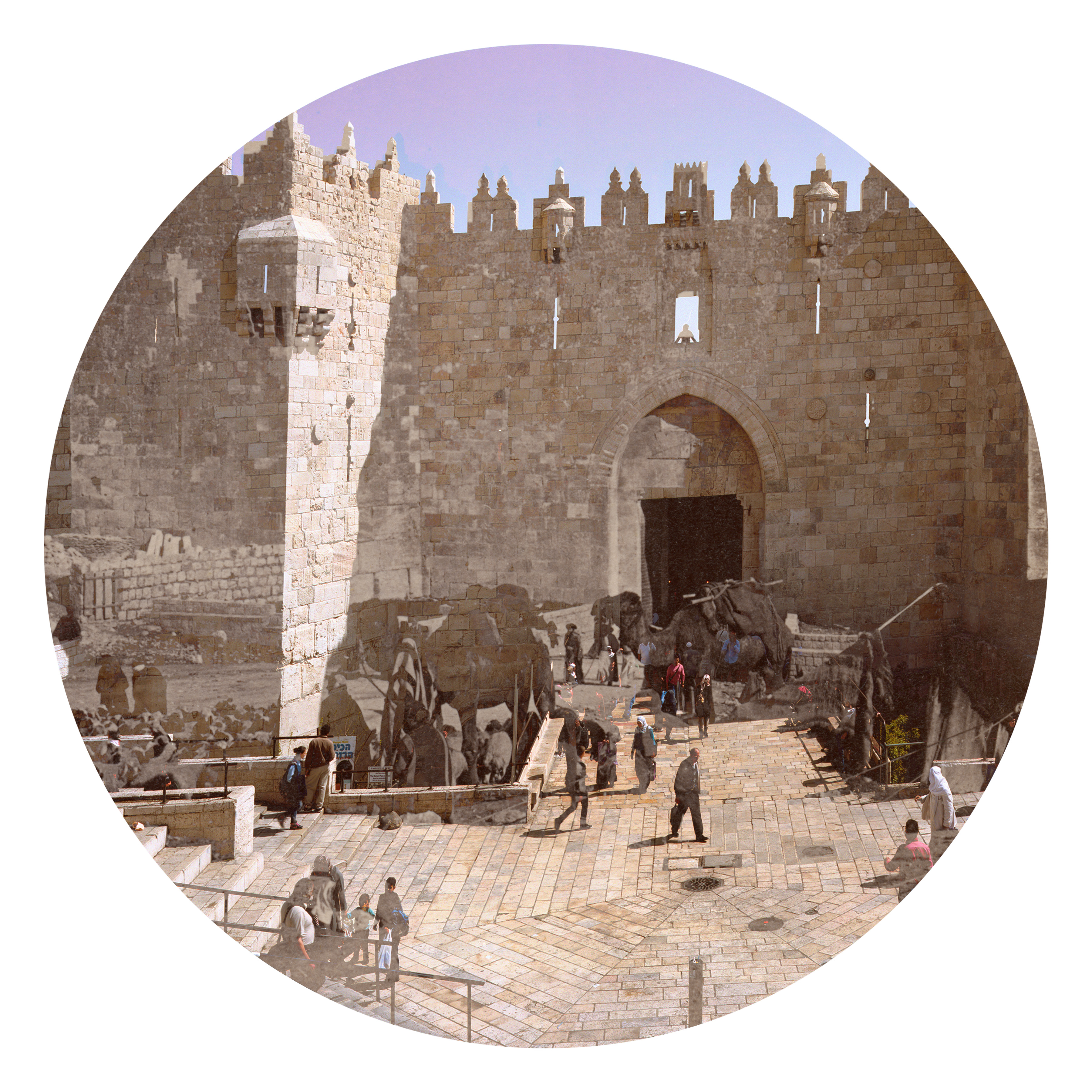

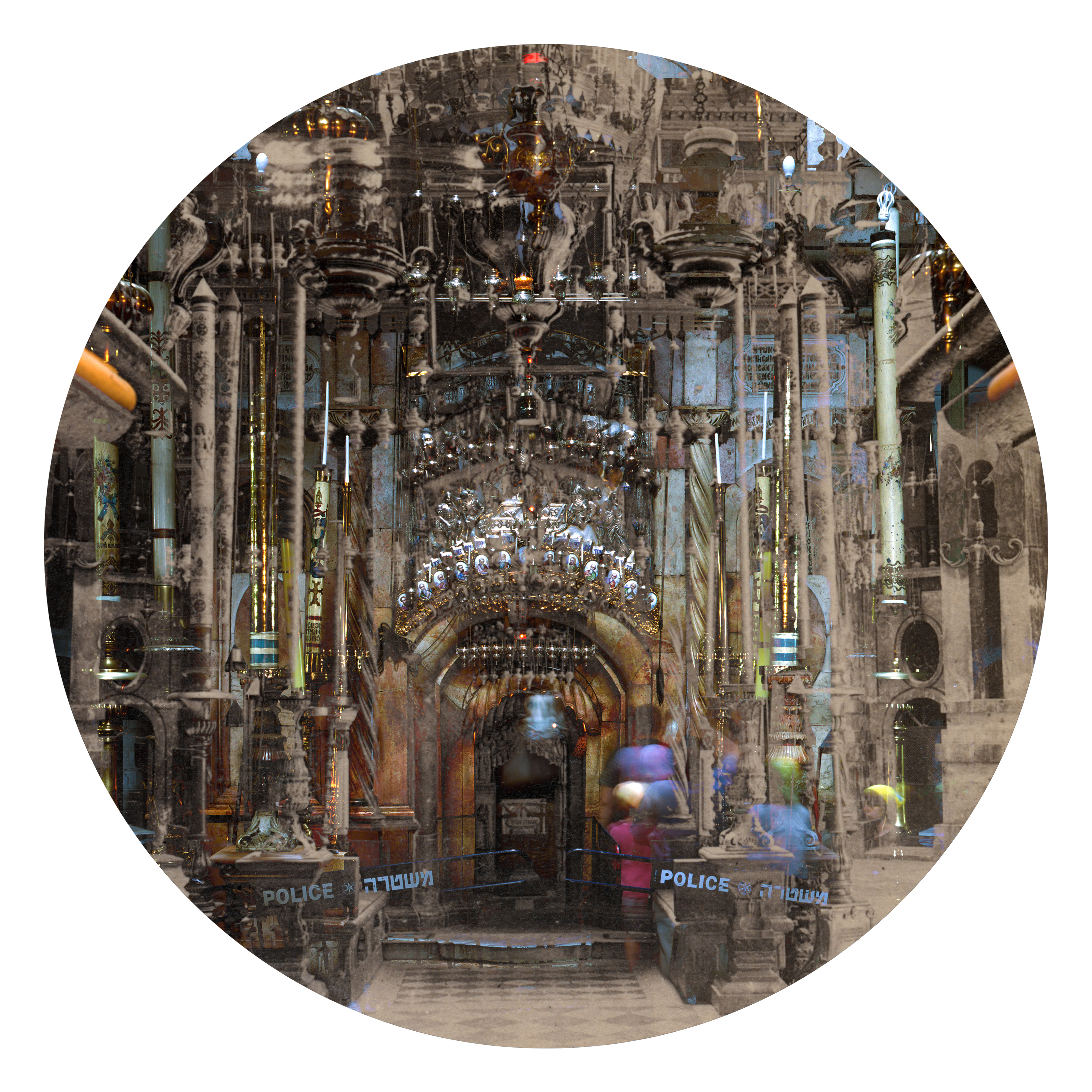


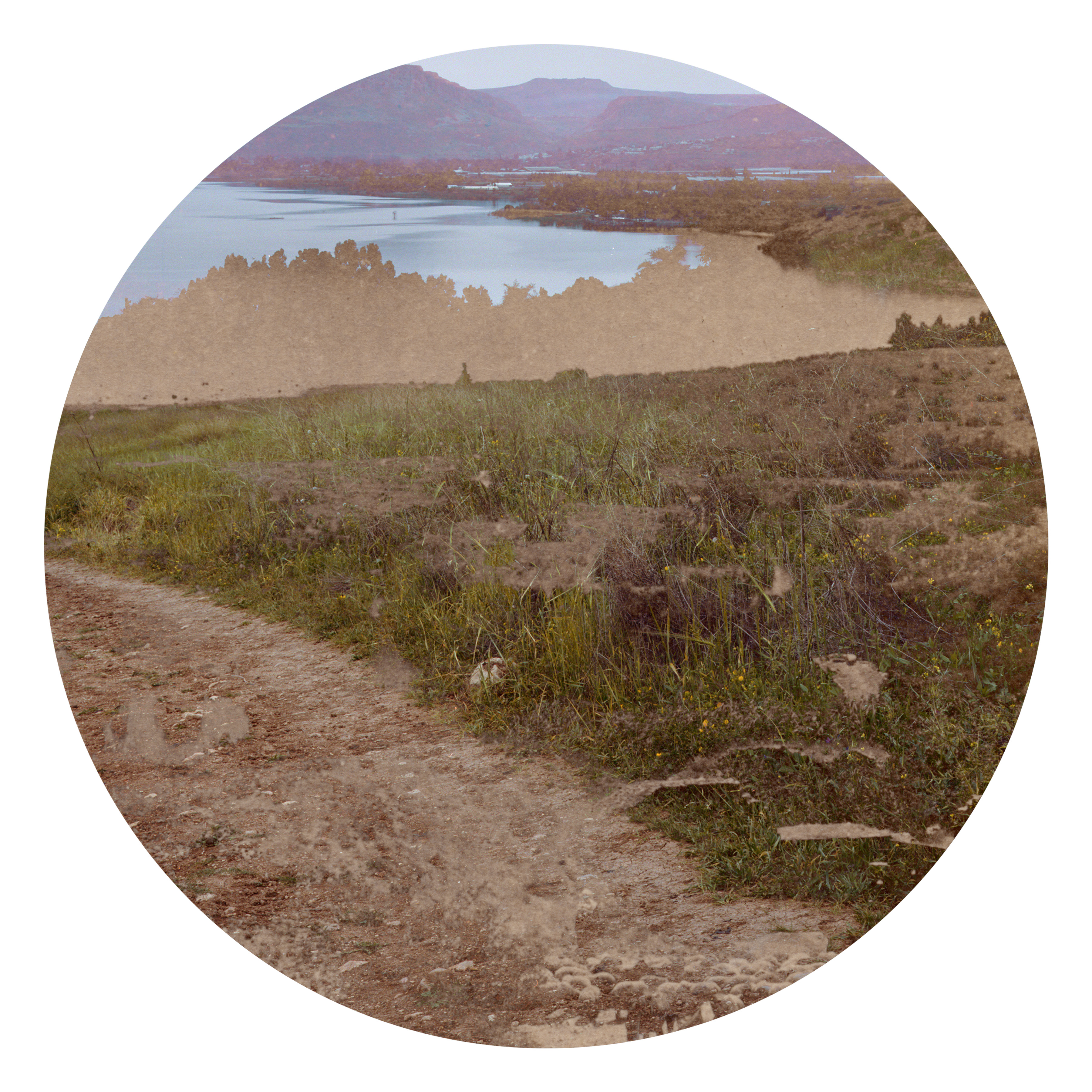


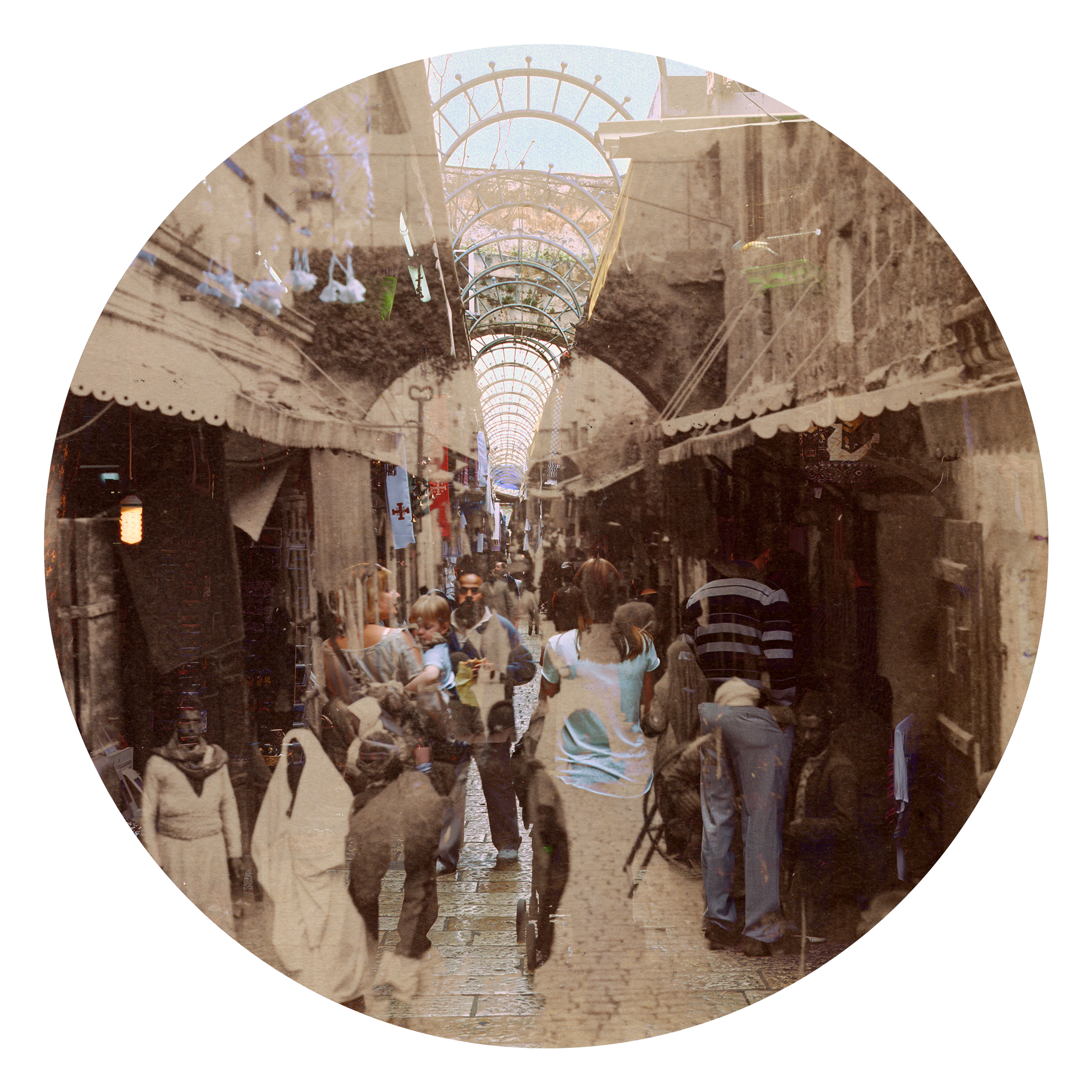


For years I've been drawn to the captivating three-dimensionality that appears when one looks through a stereoscope at a pair of images. It's fascinating to witness the subtle transformation that occurs when two photographs come together in one’s mind.
Middle Eastern Promises aims to experiment with that three-dimensional phenomenon through both rephotography and the principles of stereoscopic photography. By merging an image from a historical stereoscopic photograph taken by British photographers in Palestine circa 1900, with a corresponding updated image I rephotographed between 2014 and 2017, I hope to create a novel portrayal of Middle Eastern landscapes in a constant state of change.
The final images manifest in two distinct forms: The first is a modified stereoscopic card, presenting the original sepia photograph on the left and my contemporary color rephotograph on the right. When viewed through a stereoscope, this results in a 3D image that appears almost otherworldly. The second form involves blending the two images into a singular, circular photograph, ultimately printed on a larger scale. The historical and contemporary images converge into one surrealistic photograph—an unexpected and visually striking portrayal of an undefined era.
In both forms, the resulting images evoke a sense of chaos or disintegration—a metaphor that mirrors the current and historic troubles of the Middle East. Within the specific context of Israel and Palestine, the photographs speak to the political intricacies of fluctuating borders and the profound impact power and politics unleashes on the land.